It looks like we'll have the highest flood stages since 1937. Here's 1 pic of Memphis. The rest are of Tunica, MS. Tunica is the third largest casino area in the US. They're shut down and looks like there will be lots of damage.
Interesting side note: When the levee systems were originally built, the work was concerned too dangerous for slaves (good field hands were worth more than $4,000 back then). They hired Irish laborers to do the job.
Here's a boat at the entrance to Fitzgerald's
At Children's Palace
The password is "flood"
Too early?
Too local? (Bri prolly remembers that commercial)
Interesting side note: When the levee systems were originally built, the work was concerned too dangerous for slaves (good field hands were worth more than $4,000 back then). They hired Irish laborers to do the job.
I just finished a book about abolitionists trying to settle in Kansas Territory, and part of it the people who were not abolitionists were saying the abos wanted to get rid of paying for slaves and making the Irish do the work or something (I can't remember the exact argument but I've been surprised how much the history in that work of fiction has cropped up in things I've seen online lately.)
This has been on my mind a lot lately...
[YOUTUBE]7GOCAC8FCqE[/YOUTUBE]
[SIZE="1"]FYI: John Lee Hooker is 78 yrs old in this vid.[/SIZE]
Here is ON the river ,
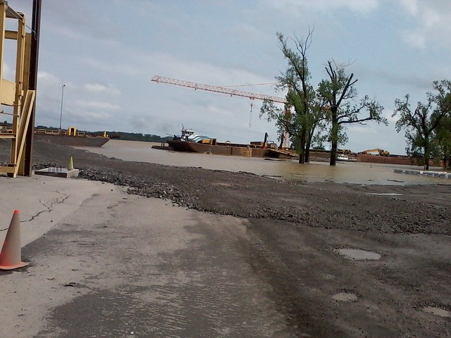 Photo047
 by
zippyt, on Flickr
here is the same spot a week later ,
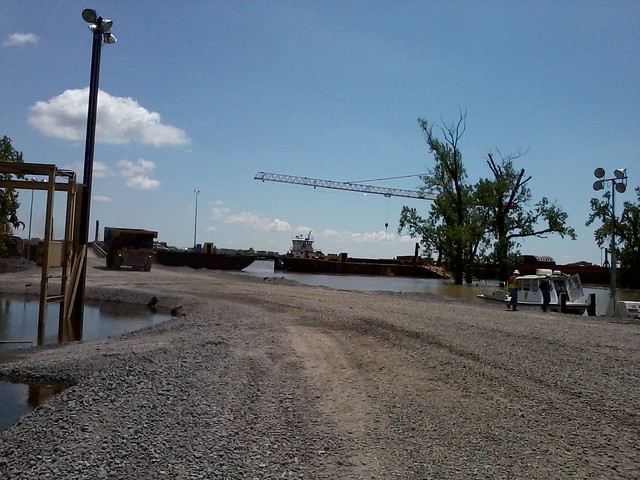 Photo062
 by
zippyt, on Flickr
2 truck scales UNDER WATER ,
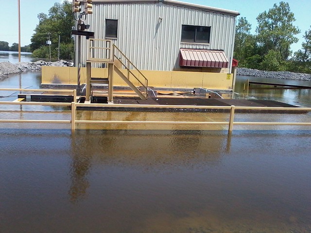 Photo061
 by
zippyt, on Flickr
And ( Hard to see ) water flowing OVER a designated 5 lane flood way on the St francis river in MO.
[YOUTUBE]U8nu_4rMXu8[/YOUTUBE]
wow. Unreal. So sorry this is happening to some people - I'm bummed about a moist basement!!
and yeah, InMo, I DO remember that commercial! allllll the rich and lucky kids got to go to Children's Palace (the password is FUN!)
Dear Mother Nature,
Pls to chill out some,
Tnx,
Hoomins.
[COLOR="LemonChiffon"]
P.S Sorry about the climate change.[/COLOR]
yeah the water it UP a Bit ,
This is the I40 Bridge ( new bridge , in Memphis ) looking West
Bottom pic is Normal river stage
Well crap!
Here is a map showing probable inundation area if the Morganza Spillway is operated at 25%. They opened it yesterday.
http://www.flickr.com/photos/37671998@N05/5717315634/sizes/l/in/set-72157626528621473/
Here is a map showing travel times for the flood wave. Notice that once past I-10 there is a valley to the west in which the flood wave will travel north - against the land slope.
http://www.flickr.com/photos/37671998@N05/5717316240/sizes/m/in/set-72157626528621473/That is reasonably shocking in scale.
[YOUTUBE]KqZ95a249p0[/YOUTUBE]
From Randy Newman's Louisiana 1927
Louisiana, Louisiana
They're tyrin' to wash us away
They're tryin' to wash us away

Vicksburg, May 15th, 2011.
People have waterfront property who never had waterfront property before.
People have waterfront property who never had waterfront property before.
It's not the waterFRONT that is the problem, it's the water surface.
A buddy of mine took this photo. Evacuating deer trophies:
[ATTACH]32415[/ATTACH]
Well ya Gotz to save the Good stuff !!!
That looks like Image of the Day.
The water has come on down ,
[YOUTUBE]eVild29Qm8E[/YOUTUBE]