
|
|
|||||||
| Image of the Day Images that will blow your mind - every day. [Blog] [RSS] [XML] |
|
|
Thread Tools | Rate Thread | Display Modes |
 12-31-2003, 10:58 AM
|
#1 |
|
Radical Centrist
Join Date: Jan 2001
Location: Cottage of Prussia
Posts: 31,423
|
12/31/2003: Bam quake satellite images
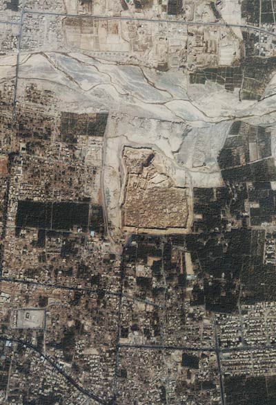 Archer pointed to this very fine satellite image of the earthquake destruction of Bam, Iran. The image was taken one day after the big quake. I took the 1.4 Meg, 3000x3000 image, selected a decent, representative section of it, and sized it for our consumption above. The middle of the image is the mud/brick citadel that had been the world's biggest mud fortress. I isolated on it and created this image. 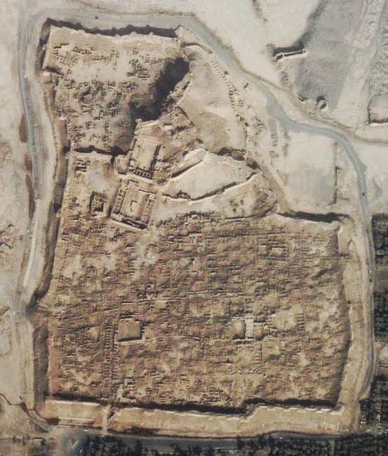 Like the video of this has shown, it's just not there anymore. It would be great to have a before / after comparison. On the first image, it's hard to see what's destroyed and what's not. The darkened areas look like trees. The lower right area seems to have been hit less hard. It seems like the area to the left of the citadel would look more like that section at the lower right, but the buildings are almost completely gone. And it's not clear how much of that crack across the top middle used to be... stuff. |

|

|
| Currently Active Users Viewing This Thread: 1 (0 members and 1 guests) | |
|
|


 Threaded Mode