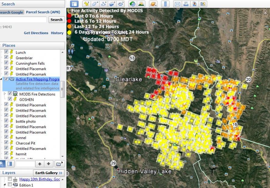
Instead of reading news reports about the fires and trying to interpret what they mean and where they are, just go directly to the source:
http://activefiremaps.fs.fed.us
And click on "Download KMZ File" which you then open with Google Earth. You will have real time
MODIS satellite data superimposed on Google earth to show you where every wild fire in the USA is located and how long it's been burning.