Buzzfeed has an interesting article about domestic surveillance flights.
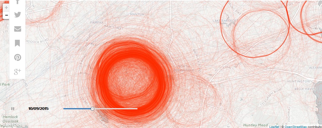
It hadn't occurred to me, but sites like flightradar24 that track flights can also be used to track the FBI, DHS, and law enforcement. If you look at flight patterns long enough, you start to see certain planes that fly in circles at a low altitude. And they go up day after day after day and fly the same exact circle over and over. A team of reporters compiled data over months last fall and have posted a map at the buzzfeed link above so you can see what areas in your city are under constant surveillance. It's pretty amazing.
A couple circles are over my house, but centered over spots a mile or so away.
WTF are they looking for in Burke VA? Is a terrorist hanging out in a house there? They have it under very heavy surveillance.
Go to the link and put your own town in. Zoom out, look at the hot spots around the country. Why the finger lakes?