Beletseri finds another gem. We can put this in the "earth as art" category, or the "cool satellite images" category...
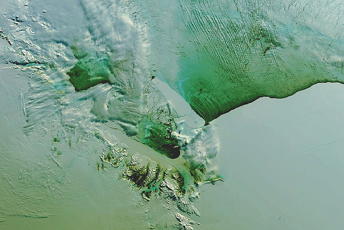
We're looking at Antarctica, and smack in the middle of this satellite image is an iceberg. The lower part of the image is the Ross ice shelf, and the top part of the image is sea. Jutting off from the ice shelf, pointing up and to the left, is the iceberg.
It may not seem impressive, but consider the scale here; that iceberg is 100 miles (160 km) long. If you stood in the middle of it you would see nothing but ice in every direction.
And so they named it: B-15A. (Bea for short?)
For two and a half years, this thing didn't move much because it was stuck on the ocean floor. This in turn screwed up the local weather, by messing up the expected ocean currents. Nobody but penguins and researchers cared, but apparently they all had a rough time of it for a while.
But if you look closely at the iceberg, about a quarter of the way up, you notice that it's cracked the whole way through. This only happened recently, October 7 in fact, when a storm passed trough that had 75 mph (120 kmh) winds. (This image was taken about two weeks later.)
If you go to the
full story you will find a black and white image that's more recent; the thing really has cracked right up, and the larger piece has moved away a few miles. The larger piece is still named B-15A - they probably have some sort of secret iceberg-naming rule that says the larger parts keep the old name if it breaks up.